

Friday, 31 July 2026
Thursday, 30 July 2026
Wednesday, 29 July 2026
Monday, 27 July 2026
Scams and the art of spin ...
It's all part of Thai government/regime's disinformation campaign to justify its war crimes and illegal occupation of Cambodia's territory to Thai people as well as the international community through social media platforms and Thailand's own national propaganda outlets. Unfortunately, people's opinions about others are or can be shaped and influenced by what they read or hear at face value no matter if the piece of information received is selective, falsified or all the facts pertaining to it unverified.
Thus, for example the Thai military and media recently claimed Cambodia 'deployed 250 drones over Thai territory in one day' or so while there has been no concrete evidence to substantiate the claim. Yet, Thai politicians and their aligned media keep repeating such claims as long as doing so helps to deflect domestic and international scrutiny away from the truth and Thailand's own culpability.
As for drone use Thailand's military is equipped with some of the most sophisticated drones existent and is known to be manufacturing these weapons by itself and the Thai military had used them widely throughout the recent clashes with Cambodia along with cluster ammunitions and toxic gas.
Thus, claiming that Cambodia deployed drones during and in the aftermath of the war at least helps to leverage and lessen the burden of guilt in Thailand's actual exclusive deployment of these weapons vis a vis an ill-equipped adversary?
In terms of transnational crimes such as scam activities Cambodia is perhaps not perfect but these are hardly confined to the country alone and recent credible media reports over Thailand's own involvement in these illicit trades and activities, including stockpiling of hundreds of tons of cocaine as well as the on-going prosecution cases of Thai and foreign nationals caught smuggling heroin from Thailand would seem to indicated Thailand to be the heart and hub of these transnational crimes.
-Social media
Thursday, 23 July 2026
Japan Bets on Southeast Asian Autonomy with Cambodia Aid

Two Japanese naval ships dock at Ream Naval base in April 2025. Photo by AP
By: Sao Phal Niseiy
July 22, 2026, 7:15 PM
CamNess
By: Sao Phal Niseiy
July 22, 2026, 7:15 PM
CamNess
PHNOM PENH – Japan has provided Cambodia with a new aid package under its Official Security Assistance (OSA) scheme, signaling growing defense engagement with the country and with Southeast Asia.
The move comes as Cambodia's border standoff with Thailand continues to simmer, though the aid is modest and analysts caution against reading too much into the timing.
The assistance was formalized through the signing of notes worth about $3 million between Japanese Ambassador Ueno Atsushi and Defense Minister Tea Seiha on July 19. The package covers military communications equipment for the Royal Cambodian Army and patrol boats for the Royal Cambodian Navy.
The Japanese Foreign Ministry said Cambodia sits at the core of the Southern Economic Corridor in the Mekong region and is a comprehensive strategic partner, adding that its development matters for stability and prosperity "not only in ASEAN but also in the entire region."
"This project is to provide communications equipment to the Royal Cambodian Army and patrol boats to the Royal Cambodian Navy, and contributes to enhancing security capabilities of Cambodia," the ministry said, adding that it would also help maintain regional peace and stability and strengthen security cooperation between the countries.
Cambodia is separately seeking to establish its first Communications School, a project expected to be developed in cooperation with the Japan Ground Self-Defense Force and the Royal Cambodian Army.
Tuesday, 21 July 2026
UN human rights envoy to visit Cambodia for 12‑day fact‑finding mission

– The United Nations Special Rapporteur on the situation of human rights in Cambodia, Tom Andrews, will begin a 12‑day mission to the country Monday to assess a wide range of rights issues, the Office of the UN High Commissioner for Human Rights (OHCHR) announced.
The visit, running from July 20 to 31, will cover concerns including human trafficking, border disputes, freedom of expression, freedom of association and peaceful assembly, as well as the rights of people in vulnerable situations.
According to the OHCHR, Andrews will meet government officials, local authorities, civil society representatives, victims and survivors of alleged abuses, and other stakeholders.
His itinerary includes Phnom Penh, Banteay Meanchey province and Siem Reap province.
A press conference is scheduled for 14:30 local time on July 31 at the Himawari Hotel Apartment in Phnom Penh, with attendance limited to accredited journalists.
The findings of the mission will be presented to the UN Human Rights Council in October 2026. Andrews was appointed Special Rapporteur on Cambodia by the Council on March 31, 2026.
The OHCHR said the mission aims to provide an independent assessment of the human rights situation and to engage with all parties concerned.
It added that the Special Rapporteur’s recommendations would be intended to strengthen protections and encourage constructive dialogue between the Cambodian government, civil society and international partners.
------------
By: Minea Son
©KPT English
Monday, 20 July 2026
Thursday, 16 July 2026
Cambodia aspires to shed its dependencies while staying connected
As it seeks connectivity, Phnom Penh must build diplomatic bridges with as much effort as it constructs ports and canals
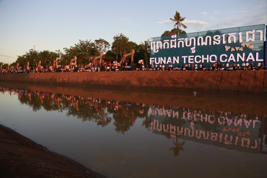
People arrive at the construction site of the Funan Techo canal along the Prek Takeo channel in Kandal province, Cambodia, on August 5, 2024. Photo: EPA-EFE
Stefano Arroque is a researcher in EU affairs, Central European politics and EU-Southeast Asia relations.
Published: 5:30am, 15 Jul 2026
scmp
Connectivity can be an ambiguous term. Different states use it in different ways at different times. In Southeast Asia, as in other regions where regional diplomacy exists in the backdrop of ever-stronger great power disputes, connectivity lies in the conflux of economics, trade necessities and the unyielding pressure of geopolitics.
In few countries is this more evident than in Cambodia, where investment in transport logistics has been a political and diplomatic fixture for at least two decades.
Last year’s brief but intense armed conflict with Thailand, and the border closures that ensued, were nonetheless a watershed moment. The border closures sent major shock waves through Cambodia’s economy. Until May 2025, the border was one of the main entry points for Cambodian goods into the global economy, benefiting from Thailand’s port infrastructure and already established maritime network.
From the beginning of the hostilities, analysts questioned the nature of Cambodia’s economic resilience. Reliance on Thai companies and exports in certain strategic sectors such as oil and energy, the heavy use of Thai roads and ports, and the prospect of a long war cast doubts on Cambodia’s short-term economic prospects. For Cambodia’s connectivity plans, the border conflict appeared at first to be a swansong. It was, instead, a perfect storm.
Sunday, 12 July 2026
Resurrecting the jungle law: Thailand’s toxic mix of strategic paranoia and opportunistic irredentism

Cambodia re-proposes to Thailand that a meeting be convened on border demarcation. Supplied
KT
Statesmen do not resort to severing ties with neighbouring countries easily. In the theatre of regional politics, a familiar pattern usually emerges during electoral periods: political factions stoke border tensions just to win an election, only to quietly normalise relations later. Yet, the Thai administration has shown absolutely no effort to normalise relations in the aftermath of its political transition, choosing instead to sustain an atmosphere of hostility. When the standard electoral playbook is abandoned so completely, we are forced to look at the second major pattern of international friction: the perception of an existential threat.
The central riddle of this crisis lies in the sheer, staggering asymmetry of the conflict and Bangkok’s reckless disregard for the global legal order. No official explanation from Thailand could ever convince a rational observer that Cambodia was genuinely invading its territory or posing an existential threat to its survival. No conventional logic can justify Thailand’s actions as an act of legitimate self-defence under Article 51 of the UN Charter.
The scope of Thai military aggression has completely shattered any legal framework of proportionality and necessity. The deployment of advanced F-16 and JAS 39 Gripen fighter jets to execute deep-strike missions, the dropping of massive, one-tonne MK84 bombs on Cambodian soil, and the heavy utilisation of military drones for cross-border attacks and surveillance have converted a localised frontier dispute into a brutal campaign of aerial devastation. Most damningly, the indiscriminate bombardment extending up to 80 kilometres deep into Cambodian territory represents a severe, unprovoked violation of Cambodia’s sovereignty and territorial integrity.
Friday, 10 July 2026
Border Tensions Rise as Thai Political Turmoil Spills Over; Experts Urge Diplomacy

— Rising political uncertainty in Thailand is casting a shadow over the fragile ceasefire with Cambodia, with experts in Phnom Penh warning that domestic pressures in Bangkok could heighten tensions along the frontier. Yet they stress that a new armed conflict is not inevitable.
Thailand’s Prime Minister Anutin Charnvirakul faces mounting challenges, including protests by shrimp farmers, legal disputes and a fragile coalition. Critics argue his administration should focus on domestic economic and governance issues rather than disputes with Cambodia.
Cambodian experts say such instability has historically coincided with renewed attention on border disputes, often used to stoke nationalist sentiment and divert attention from internal problems.
Political analyst Kin Phea said the risk of escalation exists but depends on multiple factors, including the role of the Thai military and what he described as Thailand’s territorial ambitions.
He urged Cambodia to prepare for all scenarios by maintaining military readiness, protecting sovereignty and supporting civilians if tensions worsen.
At the same time, he called for continued use of diplomatic channels — bilateral mechanisms, ASEAN frameworks, the United Nations and international law — to reduce misunderstandings.
Geopolitical analyst Gnel Rattha echoed that assessment, saying tensions were real but the likelihood of a third armed conflict remained low.
Tuesday, 7 July 2026
Korean Traveler Defends Cambodia Against 'Malicious' YouTube Video, Questions Thailand's Motives
Cambodia
is seen by her neighbours - to the East and West generally - as a poor
country with half of the population known to be "beggars" and the people
are still "mentally and intellectually backward and uneducated".
Thailand, for example, on the other hand is a country of over 70 million
people with far greater income per capita; better educated and
wealthier citizens, some of whom are part of Thailand's organised cyber
army online formed to project a positive image of Thailand on the
international stage while painting negative pictures of its neighbours
such as Cambodia. In the wake of the recent border conflict Thailand
attempted to cripple Cambodia further economically by shutting down
border crossings between the two countries as well as reportedly cutting
access to the internet via Thailand.
Most of international media
reporters who came to cover the border conflict were based in Bangkok
(as they were in the 2008 -11 war) and viewed the situation through Thai
lens - or 'Thailand'! When one travels and observes one will often find
that most countries have their share of things that are either positive
or unsavoury while the unsavoury ones generally have nothing to do with
the greater majority of the people in those countries.
The vast
majority of Cambodian people possess that warmth, caring and nobility in
their national trait or character and the 'poorer' they are the more
pronounced these characteristics become. It's arguably partly or mainly
this instinctive national trait that places trust, kindness, principle
and fraternity before caution and craft that has rendered Cambodia an
easy prey for her voracious neighbours - as being witnessed to this very
day.
- Social media

PHNOM PENH, July 6, 2026 – A Korean traveler has publicly condemned a YouTube video that allegedly portrays Cambodia as a dangerous "scam site," defending the Kingdom's safety and criticizing what he described as an attempt to distort the country's image for views.
In a social media post, Kwon Jae-min expressed strong disapproval of the video, stating that he has visited Cambodia many times and knows the local situation well. He described Cambodia as a country rich in historical and cultural heritage, such as Angkor Wat, and emphasized that the locals are "innocent and kind." He added that travelers can visit safely if they follow basic safety protocols and obey the law.
Mr. Kwon accused the YouTuber of spreading false incitement and extreme fear to raise views, calling the content "malicious" and "provocative." He questioned why the YouTuber did not address issues in Thailand, including taxi and ferry thefts, call center fraud, and land scams targeting foreigners—problems that, he said, regularly appear in the news.
"If you are going to destroy someone else's country, please look at your own country's fraud and crime issues first," he wrote.
Mr. Kwon also pointed out that the Cambodian government has been taking strong measures to combat international financial crimes and illegal call center operations, and that major tourist destinations such as Phnom Penh and Siem Reap are safe for travelers who exercise basic common sense.
He further questioned whether the real scam and crime targeting tourists is in Thailand, citing notorious land fraud around the royal palace, unfair fines targeting foreigners, and the country's role as a money laundering corridor for large-scale illegal call center fraud.
"Before blaming others, solve the serious crime rate and judicial gap in your own country," he concluded.
Saturday, 4 July 2026
Friday, 3 July 2026
New York Gallery Surrenders 20 Artifacts Thought Looted From Cambodia
The Madison Avenue business turned over stone statues and other items that it had purchased from an art dealer accused of trafficking in illicit objects.

A stone statue of a mythological creature from Cambodia, thought to have been created in the 10th century, was one of the 20 artifacts surrendered by a Manhattan gallery. Credit...via U.S. District Court filing
By Tom Mashberg and Graham Bowley
July 2, 2026, 6:08 p.m. ET
NYT
A New York gallery has surrendered 20 valuable ancient artifacts linked to Douglas A.J. Latchford, an art dealer who was accused of trafficking in items looted from Cambodia, according to court documents filed last week.
The stone and bronze items, dating from the 2nd century B.C. to the 13th century A.D., include depictions of Khmer deities and mythical figures carved from sandstone and bronze ceremonial objects. They were acquired from Mr. Latchford by the gallery between 1995 and 2005, according to a forfeiture complaint filed in the Southern District of New York on June 25.
Investigators said the gallery had decided to relinquish them after being approached by the Department of Homeland Security with evidence that the objects had been illegally looted from Cambodia. Mr. Latchford, the filing said, had provided the gallery with false provenance documents.
Homeland Security Investigations took custody of the objects in 2022 and 2023, but the paperwork filed in court on June 25 completed the seizure before the return of the items to Cambodia. The court papers credited the gallery with voluntarily surrendering the artifacts it had purchased from the dealer after learning more about Mr. Latchford’s activities and the history of the items.
Thursday, 2 July 2026
Wednesday, 1 July 2026
Tuesday, 30 June 2026
Russia's Defense Offer Comes With Costs Cambodia Cannot Ignore

PM Hun Manet shakes hands with Russian President Vladimir Putin in Kazan on the sidelines of the ASEAN forum. Photo by Presidential Office
By: Sao Phal Niseiy
June 29, 2026, 8:15 PM
CamNess
A week after the Kazan Summit marked the 35th anniversary of Russia-ASEAN relations, Moscow has signaled its intent to deepen ties with Cambodia in a more strategic arena. Speaking at a recent press conference, Russian Ambassador Anatoly Borovik said Russia is ready to help strengthen Cambodia's defense sector.
The offer has drawn attention, not least because Russia remains one of the world's largest arms exporters. It also comes at a sensitive moment, with Thailand's occupation of Cambodian territory fueling public calls for stronger national defense. Against that backdrop, many Cambodians may be less concerned about who provides military assistance than whether it enhances the country's ability to safeguard its sovereignty.
Russia's proposal, however, is far from unprecedented. For decades, Moscow has expanded its influence across the developing world through arms sales and defense cooperation, including in Southeast Asia.
Before the war in Ukraine, Russia supplied everything from fighter jets and submarines to advanced air-defense systems, often at prices well below those of Western competitors. It also distinguished itself by offering flexible payment arrangements—including barter deals involving commodities such as palm oil and coffee—while attaching few political conditions to its military partnerships.
តើកម្ពុជាអាចយកដីដែលថៃបំពាននោះ បានមកវិញដែរឬទេ?
The first thing Cambodia will have to start doing is implementing internal reforms. This means first of all executing zero tolerance policy against corruption at all levels of national administration, including the military, finance and economy.
Increased national budget and a heathy economy devoid of corruption and nepotism will contribute massively to modernisation and related reforms required to support a strong national defence needs from aiding a disciplined standing army, navy, air force and arms of relevant size and proportions needed to equip them.
Vietnam and Singapore are the most obvious examples of these internal reform and modernisation. When a state is strong and clean internally it is much easier to attract economic investments and build diplomatic relations with other countries and this will in turn strengthen both its own national defence means and its voice or influence on the regional and global stage.
-Social media
Saturday, 27 June 2026
សម្ដេចធិបតី បបួលថៃដោះស្រាយបញ្ហា ទៅតាមឯកសារស្របច្បាប់ ជាមួយគ្នា
The need to save and protect human lives by evacuating population away from potential flash points or border regions or by exploring all available peaceful legal mechanisms first is the right approach.
However, thinking that the other side will also willingly come to the negotiating table while they believe their more superior military muscle and de facto gains on the grounds remain unchallenged could be a grave mistake. Russia would not retreat or be willing to talk to Ukraine eventually unless the victimised party - Ukraine - is able to exert sufficient military pressure on Moscow to do so. The same scenario also applies in the Middle East. If the US and its Israeli ally could decisively defeat Iran through military force alone then there would be no room or necessity for 'talks' with Iran.
It's partly Cambodia's own neglect in building her own defence sufficiently to contain or neutralise potential foreign aggression in the first instance that encouraged Thailand's attack, and it is this perceived weakness of Cambodia to resist further military aggression or pressure by Thailand that still prevents Bangkok from resuming comprehensive GBC-JBC talks or recognising existing border treaties or boundaries as defined by the 1904 - 1907 Franco-Siam Treaties. What all this does show is that neither legality nor illegality - peaceful diplomacy/conventions vs. arbitrary military power - can be relied upon as repository or guarantor of lasting peace and of respect for each other's national territorial integrity.
Thus, the fundamental challenge for Phnom Penh (beside safeguarding lives) is how to bring enough pressure on Bangkok in order to coerce it to relinquish all Cambodian territory currently under Thai armed occupation and to make it think twice and hard before considering further future attack against its neighbour.
-Social media
Friday, 26 June 2026
Tuesday, 23 June 2026
Sunday, 21 June 2026
សាស្ត្រាចារ្យសេដ្ឋកិច្ចថៃនៃសាកលវិទ្យាល័យរាមាកំហែងវិភាគពីផលប៉ះពាល់នៃជម្លោះព្រំដែនកម្ពុជា-ថៃក្នុងរយៈពេលវែងសម្រាប់ពលរដ្ឋនិងសេដ្ឋកិច្ចប្រទេសទាំងពីរ។
Most Thais are proud to boast that they have never been 'colonised' by European powers. Yet at the same time they also feel humiliated by colonial France who coerced Thailand into returning Western Cambodian provinces annexed by Thailand/Siam prior to the arrival of the French to Cambodia or French Indochina. In fact Thailand was not the only neighbour of Cambodia to have annexed parts of Cambodia during that period. Vietnam and Laos had also seized large chunks of Cambodian territory.
When France was defeated in Europe by Nazi Germany Japan replaced France as colonial power in SE Asia and Thailand offered to play the role of an accomplice, in exchange of having Japan's patronage over the return of those "lost territories" to Cambodia/France back to Thailand.
If one follows Thai ultra nationalist line of logic to its conclusion therefore the longer term ambition of these ultra nationalists is not limited to Cambodia's hinterland in the border areas but also ultimately this is extended to all those provinces, including Battambang and Siem Reap, Thailand feels were "lost" to Cambodia following Japan's defeat in 1945.
-Social media
Cambodia Renews Calls for Thailand to Stop Land Encroachment

Military Attachés Corps visited Chey Chomneas Border Checkpoint in Pursat province. Photo from Information Minister Neth Pheaktra
By: Teng Yalirozy
June 20, 2026, 12:00 PM
PHNOM PENH — Cambodia has filed another protest against Thailand’s armed forces' ongoing encroachment activities in Pursat and Oddar Meanchey provinces, demanding the cessation of all unilateral actions on Cambodian soil.
In a statement issued on June 19, the Ministry of Foreign Affairs and International Cooperation reported that the Thai armed forces on June 17 had raised Thai national flags at the Thmor Da International Border Checkpoint in Pursat and set fire to a warehouse located on the Royal O’ Smach Hotel and Resort grounds in Oddar Meanchey.
The Thai forces also built concrete fences in the area of Ta Krabei temple in Oddar Meanchey province, the ministry stated, adding that Thailand is violating Cambodia’s sovereignty and territorial integrity as defined by the 1:200,000-scale maps.
However, Thai Prime Minister Anutin Chanvirakul refused to use the maps produced by the Commissions for the Delimitation of the Boundary between Indo-China and Siam pursuant to the Franco-Siamese Convention of 1904 and the Treaty of 1907. Instead, he said that Thailand is now using the 1:50,000-scale map, which further complicates the issue and escalates the border situation.
Friday, 19 June 2026
The New Golden Age of Laos and Cambodia

Once caught in the crossfire of America’s “secret war,” Laos and Cambodia have carried the imprint of generational trauma alongside indomitable beauty and strength.
By Pilar GuzmánPublished: Jun 18, 2026 2:59 PM EDT
“Remember not to make eye contact,” said the night watchman as I knelt nervously outside the front gate of my hotel, a basket filled with sticky rice at my knees. At 5:30 a.m. on my first morning in Luang Prabang, I was getting ready to participate in the daily ritual of Tak Bat, or morning alms, in which hundreds of barefoot monks—some as young as 7—walk in saffron-colored robes from their local temples through the main streets to receive food offerings from locals and, in this case, tourists. I was wary of a certain kind of “cultural immersion” that can verge on commodification—or worse, appropriation—especially in a ceremonial context. But with guidance from the staff at Amantaka, I felt appropriately invisible. As instructed, with a shawl draped over my shoulder and my gaze turned downward, I emptied the basket one handful of rice at a time until the end of the procession.
This quiet ritual was my introduction both to Luang Prabang, the spiritual capital of northern Laos, located near the confluence of the Mekong and Nam Khan Rivers, and to this unlikely 24-room hotel. Occupying a former French colonial hospital just south of the city’s sacred Mount Phousi, the Amantaka lovingly and meticulously reimagines the original 1923 structure as a peaceful garden sanctuary. Like so many buildings in this jewel of a town, the hotel’s design deftly commingles Buddhist mysticism and European charm: White stucco structures with green shutters and casement windows give way to spare guest rooms that blend colonial French details with Laotian teak and rattan furnishings. There is a graceful continuity between property and place; located within walking distance of the night market, restaurants, and the Mekong River, the hotel, with its lush gardens and gracious pool and dining patio, is both an extension of and a retreat from the surrounding activity.
With limited time in this city, we stuck mostly to the UNESCO-protected old quarter—a cultural haven of 33 gilded Buddhist temple-monasteries, museums, and open-air cafés and restaurants, and called on the travel experts at Abercrombie & Kent to help distill the highlights. First up, the Royal Palace Museum, which was built along the Mekong in 1904 by the French for King Sisavang Vong, in a style blending French Beaux-Arts and traditional Lao. Serving as the royal residence until 1975, when the monarchy was overthrown, and converted into a national museum in 1995, the palace counts an impressive 14th-century gold, silver, and bronze Buddha statue called the Phrabang (after which the city itself was named) among its national treasures. In addition to all manner of crown jewels, the museum showcases the royal family’s perfectly preserved living quarters, vintage car collection, and assorted gifts from foreign countries, including a piece of moon rock from the U.S.
Monday, 15 June 2026
Saturday, 13 June 2026
Thursday, 11 June 2026
Why Cambodia and Thailand’s Peace Is So Uneasy
Khmer Circle:
'So what is Thailand actually up to?' Procrastinations, stalling tactics, breaching the terms of ceasefire agreements with Cambodia citing one excuse after another as to why it could not honour or engage those terms especially in regard to initiating border demarcation work within the agreed JBC framework, all in an attempt to buy more time for Thailand to turn its illegal land encroachments through force into forgotten fait accompli and hoping all the while that the world community will turn a blind eye to it all. If indeed, it has not already done so.
^^^
A step forward in the maritime dispute masks dangers on the land border.
By Joseph Rachman, the writer of Foreign Policy’s weekly Southeast Asia Brief.

Cambodian Prime Minister Hun Manet, left, shakes hands with Thai Prime Minister Anutin Charnvirakul, right, during a live-streamed joint conference following a trilateral meeting between the top leaders of Cambodia, Thailand, and the Philippines on the Thai-Cambodia conflict, as part of the 48th Association of Southeast Asian Nations Summit, in Cebu, Philippines, on May 7.
June 10, 2026, 12:01 AM
Cambodia-Thailand Arbitration Masks Danger
Six months after fighting ended between Cambodia and Thailand, their relationship remains dangerously unsettled.
On June 5, Thailand said it will join the United Nations arbitration process launched by Cambodia to resolve the two countries’ maritime boundary dispute. At the same time, though, Thailand announced that bilateral efforts to resolve its contested land borders with Cambodia would be put on hold. Peace talks on the land border look stalled, and small skirmishes have taken place along the border. A third round of fighting looks unlikely—but certainly not impossible.
The cease-fire remains in place, but as recently as May, Thailand accused Cambodian soldiers of firing shots along the border. Cambodia has accused Thailand of occupying areas it previously accepted as Cambodian territory. Thailand has kept the border closed despite the economic cost. Now Thailand has an excuse to abandon the border peace talks it has been slow-walking for months. Association of Southeast Asian Nations attempts to keep Thailand and Cambodia moving toward a peace deal seem to have flopped. And without change, the border dispute will remain a frozen conflict, not a solved one.
Meanwhile, what of the maritime boundary dispute now facing arbitration?
The process now being launched is the compulsory conciliation provision of the United Nations Convention on the Law of the Sea (UNCLOS). At stake is a stretch of water with an estimated $300 billion worth of energy resources under it, claimed by both Cambodia and Thailand.
Wednesday, 10 June 2026
Khmer Sbai carved in stone

In 2025, archaeologists at Cambodia’s Angkor temple complex uncovered the torso of a sandstone Buddha statue dating to the 12th–13th century. The discovery proved especially remarkable because the torso perfectly matched a head found at the same site in 1927 and preserved in Cambodia’s National Museum for nearly 100 years. Using modern technology, researchers confirmed that the two pieces once formed a single statue, allowing one of the finest surviving examples of Khmer art to be reunited after almost a century apart.
Saturday, 6 June 2026
Thai Scholar Warns Anutin Risks Another ICJ Defeat

BANGKOK, June 5, 2026 — Prominent Thai security and geopolitical analyst Surachart Bamrungsuk has warned that Prime Minister Anutin Charnvirakul’s recent position on the Cambodia-Thailand border dispute could place Thailand at risk of repeating past legal setbacks before international courts.
In an article titled “Cambodia’s Trap! Is Anutin Leading Thailand Toward Another Defeat at the International Court?”, published on June 1, Surachart cautioned that Thailand should be careful not to undermine legal principles that have previously shaped rulings against Bangkok in territorial disputes.
The warning followed remarks made by Anutin on May 27, when the Thai prime minister stated that Thailand would only recognize the 1:50,000-scale map in border discussions and that if Cambodia continued to rely on the 1:200,000-scale map, there would be no need for further talks.
According to Surachart, the statement immediately raised concerns among Thai academics and policy analysts, who warned that such a position could expose Thailand to legal vulnerabilities under international law.
He argued that previous rulings by the International Court of Justice (ICJ), particularly in the Preah Vihear Temple case, were not determined solely by map scales but by broader legal principles, including treaty obligations, state conduct and historical acceptance of boundary documents.
Thursday, 4 June 2026
The Cartographic Temper Tantrum: Anutin’s Post-Paris Panic and Thailand's Lawless Diplomacy

Opinion | Cambodia Insights
Guest Writer: Panhavuth LONG, Lawyer, PAN & Associates Law Firm
06:12 PM, June 3, 2026
Guest Writer: Panhavuth LONG, Lawyer, PAN & Associates Law Firm
06:12 PM, June 3, 2026
PHNOM PENH, Cambodia (CI) – When Thai Prime Minister Anutin Charnvirakul departed for Paris, his stated mission carried a veneer of statesmanship: he was traveling to seek historical clarity from French archives regarding the Cambodia-Thailand border. It was framed as a confident, fact-finding endeavor. Yet, upon his return on May 29, 2026, the Prime Minister delivered not facts, but a glaring diplomatic retreat. Abruptly, he declared that the internationally recognized 1:200,000-scale colonial map long cited by Cambodia "no longer exists" for Bangkok.
This sudden, erratic pivot is not a demonstration of sovereign strength. It is an exposure of an administration struggling to reconcile its political ambitions with binding treaties, begging a question that reverberates through diplomatic corridors: What exactly did Anutin learn in France that forced such a hasty retreat from historical evidence?
Imperial Archives and Inconvenient Truths
In the realm of international law and statecraft, a leader cannot unilaterally erase a map simply because it fails to serve political convenience. The Annex I map is not merely a dusty colonial artifact; it is the foundational document validated by the International Court of Justice (ICJ) in its landmark 1962 Preah Vihear ruling. If the Prime Minister genuinely sought "clarification" from President Emmanuel Macron and French authorities, the archives almost certainly offered an inconvenient truth: the historical record is immutable. France cannot, and legally would not, retroactively alter early 20th-century treaties to accommodate modern Thai political objectives. Realizing that the French archives would only reinforce the legitimacy of the very maps Thailand wishes to contest, Anutin chose to abandon the legal framework rather than engage with the rules of international jurisprudence. A state does not ask a question on the global stage if it is unprepared to handle the answer. To inquire, and then immediately declare the subject non-existent when the answer proves unfavorable, is a departure from established diplomatic norms.
Wednesday, 3 June 2026
Anutin Says the 1:200,000 Scale No Longer Counts. Surachart Bamrungsuk Tells Him the 2000 Treaty Names No Scale at All.
In hindsight colonial France should have demanded more than those returned three Khmer provinces to Cambodia. This episode only serves to remind all Khmers and their ruling administration alike that making land concessions to the Thais "in exchange for peace" only invites further Thai encroachments and no guarantee of lasting peace.
-Social media
Anutin Charnvirakul told Thai media on 27 May, on the sidelines of a trade exhibition at Impact Muang Thong Thani, that the 1:200,000-scale Franco-Siamese map Cambodia cites for its border claims no longer counts for his government, and that any party meaning to rely on that scale need not come to the table at all. He told The Nation the older scale “no longer exists” for Thailand, while allowing that his government would accept transparent technical verification of the line.
The scale Anutin set aside is not the term on which the governing instruments turn. The Memorandum of Understanding the two governments signed on 14 June 2000, and which Thailand registered with the United Nations in 2011, commits them in its first article to survey and demarcate the land boundary in accordance with the 1904 Franco-Siamese Convention, the 1907 Treaty and its annexed delimitation Protocol, and the maps that resulted from the Commissions of Delimitation. The article lists those documents and fixes no scale. That framework is still running: under its Joint Boundary Commission the two sides have located most of the 73 colonial-era markers, leaving the contested segments where the present argument sits.
Losing in Court, Thailand's Military Throws a Tantrum at the Border

CAMBODIA/THAILAND BORDER – At 9:45 a.m. on June 2, 2026, Thai military forces encroached on Cambodian territory, according to video evidence obtained by this correspondent. The footage documents repeated incursions, marking the latest provocation in a escalating border crisis. Cambodia has vowed to defend its territorial sovereignty against all aggression.
The timing is telling. Thailand is reeling from legal and diplomatic defeats. And for observers of Thai-Cambodian border affairs, the June 2 incident follows a damning pattern: Bangkok signs a peace accord, then swiftly engineers a fresh confrontation.
Since the July 2025 ceasefire, Thailand has repeatedly leveled landmine accusations against Cambodia – each time, notably, immediately after a peace deal was sealed. A ceasefire was brokered on July 28, 2025, following clashes near Preah Vihear. Just twelve days later, Bangkok alleged three soldiers were injured by a mine. Cambodian verification later exposed that Thai troops had crossed the ceasefire line. On October 26, another peace agreement was inked. Fifteen days later, Thailand again reported a mine strike and blamed Phnom Penh, prompting Prime Minister Anutin to suspend the accord. The June 2 provocation is not an anomaly – it is the modus operandi.
Cambodia initiates action with UN agency to force conciliation of maritime dispute with Thailand

by: SOPHENG CHEANG, Associated Press
Posted: Jun 2, 2026 / 08:38 AM EDT
Updated: Jun 2, 2026 / 08:38 AM EDT
PHNOM PENH, Cambodia (AP) — Cambodia’s government has filed notice under a U.N. agreement on maritime law for compulsory conciliation of a sea border dispute with neighboring Thailand, Prime Minister Hun Manet said Tuesday.
At issue is territory claimed by both that is believed to contain large, exploitable amounts of natural gas and other hydrocarbons.
The decision to take the matter to the the U.N. Convention on the Law of the Sea, or UNCLOS, comes after Thailand last month terminated a 25-year-old memorandum of understanding with Cambodia meant to resolve overlapping maritime claims.
Thailand unilaterally revoked the agreement in May after relations between the countries worsened last year after major armed clashes over their land border.
Last year’s fighting with Cambodia spurred nationalistic fervor, putting political pressure on Thai Prime Minister Anutin Charnvirakul to abrogate the pact.
In a live broadcast on TVK state television, Hun Manet said that his government had delivered formal notice to Thailand and to the U.N. secretary-general to begin compulsory conciliation proceedings under UNCLOS rules.
“Cambodia has never violated the sovereignty of other states,” he said.
“At the same time, we are unwaveringly determined to defend Cambodia’s sovereignty. Today, we continue to honor that responsibility, not through force, but through international law; not through unilateral action, but through peaceful engagement.”
Cambodia launches UN-backed process to settle maritime dispute with Thailand
By Reuters
June 2, 20265:11 AM GMT+1Updated June 2, 2026

Cambodian Prime Minister Hun Manet is interviewed by Reuters during a visit to Washington to take part in the first meeting of President Donald Trump's Board of Peace in Washington, D.C., U.S., February 17, 2026. REUTERS/Evelyn Hockstein Purchase Licensing Rights, opens new tab
Summary
Cambodia invokes UN conciliation process after Thailand ended 2001 maritime pact
Disputed maritime area estimated to hold $300 billion in oil and gas resources
Thailand has 21 days to appoint conciliators under UN process, Cambodia says
Summary
Cambodia invokes UN conciliation process after Thailand ended 2001 maritime pact
Disputed maritime area estimated to hold $300 billion in oil and gas resources
Thailand has 21 days to appoint conciliators under UN process, Cambodia says
BANGKOK, June 2 (Reuters) - Cambodia said on Tuesday it had launched a compulsory conciliation process under international law aimed at resolving a long-running maritime boundary dispute with Thailand and had informed the United Nations and Bangkok.
The move follows a Thai government decision last month to unilaterally terminate a 2001 agreement with Cambodia that provided a framework for negotiations over the disputed area in the Gulf of Thailand where the two countries' maritime claims overlap.
The Reuters Iran Briefing newsletter keeps you informed with the latest developments and analysis of the Iran war. Sign up here.
"We have taken this step to protect Cambodia's sovereignty and maritime rights in accordance with international law," Cambodian Prime Minister Hun Manet said.
Thai Prime Minister Anutin Charnvirakul, who made the cancellation of the 2001 pact part of his February election campaign, said he was not aware that Cambodia had initiated the conciliation process.
"Thailand has not yet determined when it will proceed further," he told reporters.
Tuesday, 2 June 2026
BREAKING: Cambodia Formally Notifies Thailand, UN to Initiate UNCLOS Compulsory Conciliation Process

PHNOM PENH, June 2, 2026 — Cambodia has formally notified Thailand and the United Nations of its decision to initiate compulsory conciliation proceedings under the United Nations Convention on the Law of the Sea (UNCLOS), Prime Minister Hun Manet announced on Tuesday.
The move follows Thailand's unilateral decision to terminate the bilateral Memorandum of Understanding (MoU) that had served as a framework for discussions on overlapping maritime claims between the two countries.
According to Hun Manet, the Royal Government of Cambodia has issued an official notification to both the Thai government and the United Nations to begin the process of compulsory conciliation under UNCLOS, marking a significant step in the long-running maritime dispute between the neighboring countries.
The compulsory conciliation mechanism is a dispute-settlement procedure provided under UNCLOS that allows parties to seek an independent review and recommendations from a conciliation commission when negotiations fail to produce an agreement. While the commission's recommendations are not legally binding, the process is recognized as a formal international legal avenue for resolving maritime disputes.
Cambodian officials have repeatedly stated their preference for resolving disputes peacefully and in accordance with international law. In recent weeks, senior Cambodian leaders, including Deputy Prime Minister and Foreign Minister Prak Sokhonn, have emphasized the importance of legal and diplomatic mechanisms in addressing outstanding issues with Thailand.
The latest development comes amid heightened diplomatic tensions between the two countries over both land and maritime boundary issues. Cambodia has maintained that international legal frameworks should guide dispute resolution, while Thailand has advocated continued bilateral discussions.
No immediate response was issued by Thai authorities following Hun Manet's announcement.
The initiation of the UNCLOS mechanism is expected to open a new chapter in efforts to address overlapping maritime claims in the Gulf of Thailand, shifting part of the dispute from bilateral negotiations toward an internationally recognized legal process.
Monday, 1 June 2026
A 1908 Treaty Document Holds Against Anutin's 1:200,000 Erasure

On 27 May 2026, Thai Prime Minister Anutin Charnvirakul told reporters at the Thaifex Anuga Asia 2026 exhibition in Bangkok that the 1:200,000 scale "no longer exists" for Thailand's administration. He said Thailand uses 1:50,000 maps in specified sectors and asked UNESCO to hear Thailand before publishing any heritage assessment. The Thai-language Naewna report carried an additional clause translated as: if Cambodia still uses the 1:200,000 scale, they "do not need to come and talk to Thailand."
On 26 October 2025, Anutin had told Nation Thailand that Thailand had never accepted the 1:200,000 map and that LiDAR survey would render the older instrument obsolete.
On 25 May 2026, Anutin met President Emmanuel Macron at the Élysée Palace. Both sides announced they would advance the France-Thailand 2026-2028 Joint Action Plan toward strategic partnership.
The 1:200,000 Annex I map was prepared in Paris by French officers under the 1904 Franco-Siamese Boundary Convention. A Mixed Commission with Siamese members worked the demarcation 1904-1907. In 1908, fifty sets were allocated to the Siamese Government from a full distribution of approximately one hundred and sixty sets. The ICJ in 1962 found Thailand bound to the map through acceptance. The 2013 interpretation judgment reaffirmed the Annex I line.
Subscribe to:
Posts (Atom)